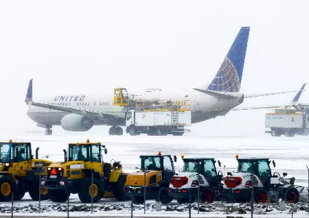
Heavy snowfall in the Midwest has caused the cancellation of more than 1,600 flights

People of northern states are hunkering down as whiteout conditions are expected on Wednesday afternoon and evening due to heavy snowfall and strong winds. A foot of snow was expected to fall in South Dakota and Michigan from another wave of storms, according to the National Weather Service. Travel across Wyoming, Wisconsin, and Minnesota may continue to be dangerous, if not potentially fatal, due to snowfall rates of up to 2 inches per hour, subfreezing temperatures, and winds of 50 mph. On Wednesday morning, the number of cancelled flights in the US started to increase. Almost 1,600 flights had been cancelled as of 7:30 p.m. ET, with Minneapolis International Airport cancelling half of its arrivals. Also, there have been delays on more than 5,200 aircraft nationwide. Chicago, Colorado, Detroit,and Milwaukee also suffered greatly. Once highways got slippery or blocked completely, schools in Minnesota, Wisconsin, and the Dakotas made closure announcements. In areas with little precipitation, forecasters warned that as much as half an inch of ice may build up throughout the Great Lakes into Thursday. When the governor said on Twitter that he would order the state's National Guard, transportation department, and state police to be prepared to handle situations, a no-travel advisory and highway restrictions were still in place in several areas of the state. According to the NWS's daily bulletin, Wednesday is expected to bring noteworthy weather to roughly half of the country as a whole.
A lagging cold front in California caused winds to reach 50–60 mph, endangering power lines. More than 65,000 households and businesses without electricity in the state as of Wednesday night. In Arizona, some 8,000 people were without electricity. On Wednesday, snow started to fall in Western mountain ranges as well, with higher elevations expecting up to 2 feet of snowfall, according to the NWS. This might result in a winter mix, hail, or heavy rain throughout lower altitudes of California, causing concern for a state that has already seen disastrous floods. And Thursday might not offer much solace. According to the NWS, a second storm will hit the West Coast on Thursday and bring the possibility of further rain and snow. As Southern California's temperatures increase. While the Southeast and Mid-Atlantic were predicted to have highs in the 70s and 80s on Wednesday, the temperature could not reach beyond 50 degrees. The NWS stated in its advisory that the expected temperature gradient from the Mid-Atlantic into New England Thursday is significant, with highs in the 80s in Virginia down to the single digits in northern Maine. According to the AP, if temperatures in Washington, D.C., reach 80 degrees on Thursday as predicted, they will surpass the previous high of 78 degrees set in 1874. Yet it's unlikely the warm front will last much longer. The same storm that is engulfing the plains on Thursday will start to move into upstate New York and central New England by the weekend, bringing lower temperatures further south.
Related queries to this article
- Snowfall
- Snowfall Midwest
- Flights
- South Dakota
- Michigan
- National Weather Service
- NWS
- Wyoming
- Wisconsin
- Minnesota
- Minneapolis International Airport
- Chicago
- Colorado
- Detroit
- Milwaukee
- New York
- central New England
Read more articles and stories on InstaSity Trending Topics.


